Research
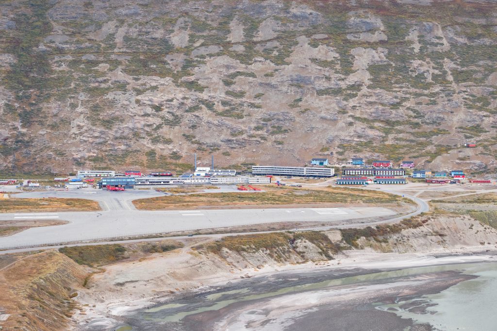
Kangerlussuaq offers an accessible and comprehensive base from which researchers can investigate a continental Arctic landscape under transition due to climate change. Several distinct ecosystems are within easy access of the town and enable a vast array of scientific research.
Note: To conduct research in Greenland, it may be necessary to arrange one or more permits ahead of time. Please consult our Permits page for further information.
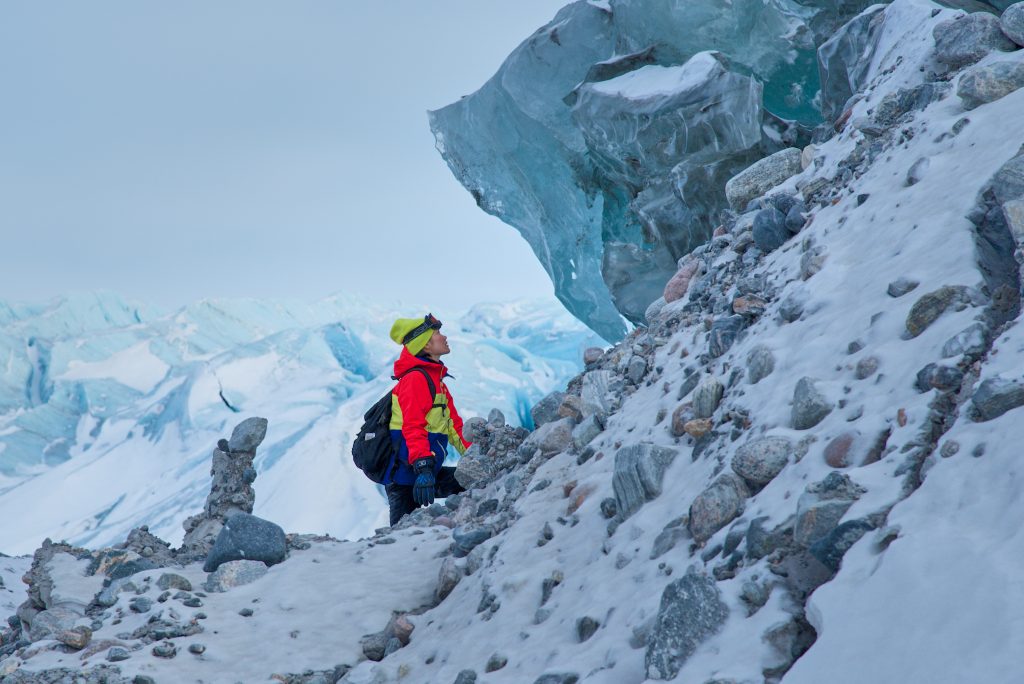
Greenland Ice Sheet
Kangerlussuaq is the main base of operations for Arctic scientists wishing to study the Greenland Ice Sheet. It is the launching point for researchers heading to the two primary bases on the icecap:
- Summit Station – the only high altitude, high latitude, inland, year‐round observing station in the Arctic
- EastGRIP – the East Greenland Ice Core project
and is where most logistics for these two camps, and additional field camps in the area, can be arranged.
For researchers more interested in studying the edge of the Ice Sheet, there is easy access via a gravel road (the only road access anywhere in Greenland) to Point 660 and the Russell Glacier, which ultimately flow into the Kangerlussuaq Fjord via the Watson River. This type of research does not require high-level logistics as the work sites can be reached by car within 2 hours.
Marine ecosystems research
The fjord of Kangerlussuaq is approximately 165km long, varies from 1 to 6km wide, and is largely influenced by two major river systems (the Watson River and the Orkendalen river) that contain meltwater from Kangerlussuaq’s glaciers. This makes it a perfect laboratory in which to study how mass loss from the ice sheet affects sea level rise, and how an increase of freshwater outflow affects marine ecosystems.

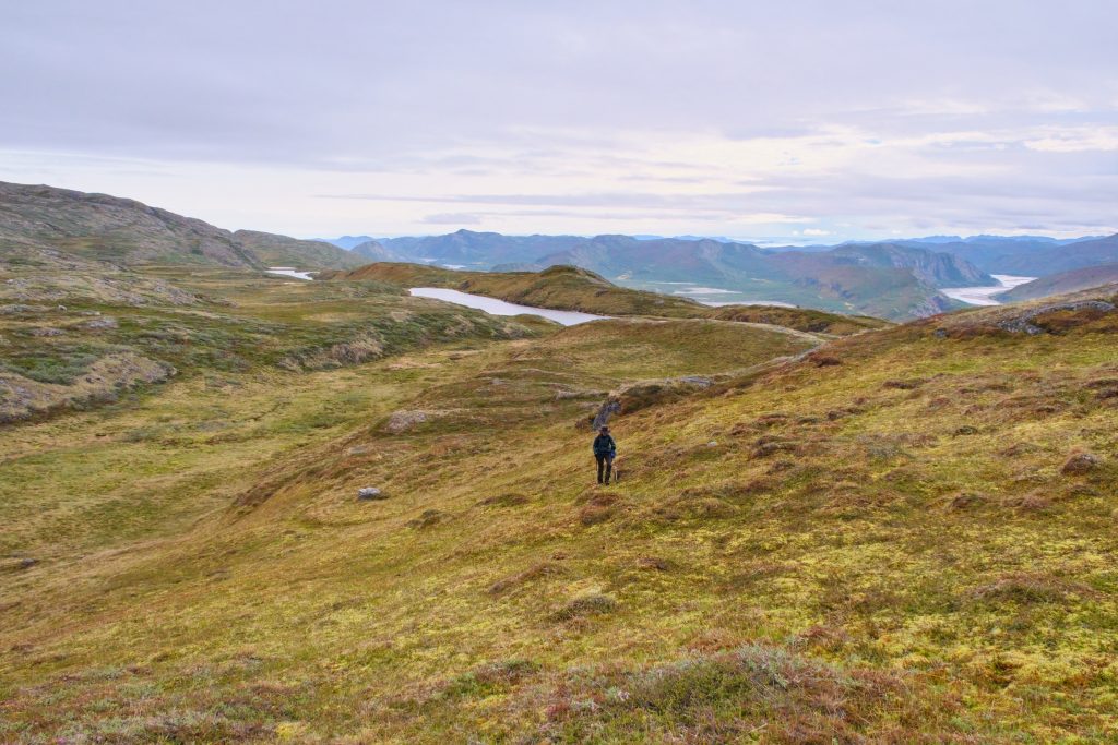
Terrestrial ecosystems research
Key terrestrial ecosystems within Kangerlussuaq’s extensive backcountry include:
- tundra characterized by deciduous shrubs, forbs, and graminoid species
- steppes with low mountains and a multitude of lakes of various sizes and salinities
- permafrost at varying surface depths
- flood plains with dunes, and braided, meandering river systems
- glaciers and moraines
- abundant wildlife including many bird species, caribou, musk oxen, arctic hares, and arctic foxes
- the Eqalummiut Nunat and Nassuttuup Nunaa RAMSAR site
These ecosystems have undergone significant transformations over the past few decades due to higher temperatures, and present researchers with the opportunity to study the ongoing effects of climate change on diverse environments.
Research within the UNESCO site
Aasivissuit – Nipissat is one of the three UNESCO World Heritage sites in Greenland. It encompasses 417,800ha and stretches for more than 200km from the Davis Strait near Sisimiut to the Greenland Ice Sheet near Kangerlussuaq. It presents unique and diverse opportunities for terrestrial, marine, and wildlife research, as well as archaeological investigations.

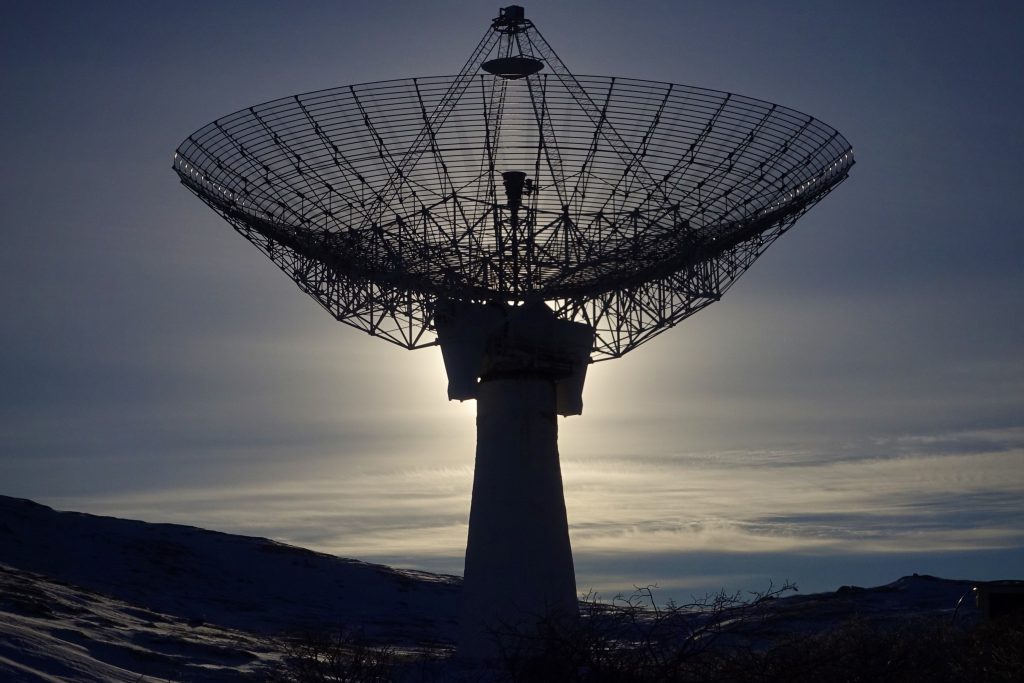
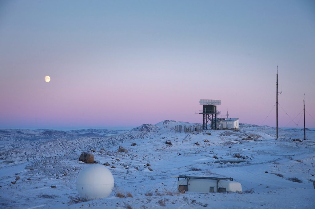
Atmospheric research
The Sondrestrom facility at Kellyville was operated by the National Science Foundation and the Danish Meteorological Institute between 1983 and 2018. It was primarily dedicated to scientific studies of the polar ionosphere and upper atmosphere with the following key areas of research:
- Storms and substorms
- Auroral boundaries and particle energetics
- Middle atmosphere properties
- Cloud studies
- Electrodynamics and neutral dynamics
The facility also supported non-atmospheric research with instruments funded by US agencies and other foreign institutions (mainly Denmark, Germany, and Luxemburg).
A list of publications using data from Sondrestrom can be found on www.isr.sri.com/pubs.html
Although the housing and administrative part of the facility was dismantled in 2023, the University of New Brunswick will likely take over the scatter radar and some of the research equipment to create a new Geospace Research Facility on the site. It will be the first observatory in the world equipped to study the coupling between the Earth’s interior, surface, atmosphere, ionosphere, magnetosphere, solar wind, and Sun. This research is of critical importance to global positioning/navigation systems, communication systems, and defense systems.
Building your own research station
As a university or research institute, you have the option of using the KISS facilities, building your own research station, or renting a building for research purposes.
The Qeqqata Kommunia Municipal Plan allows for the development of facilities
- within the town of Kangerlussuaq
- to the east near the Ice Sheet along the gravel road
- to the west along the ATV track to Sisimiut
Please contact Laust Løgstrup laul@qeqqata.gl at Qeqqata Kommunia to discuss your requirements.